Halford Flood Meadow Diary (click images to enlarge)

Snakeshead Fritilliary
by Mike Hopkins
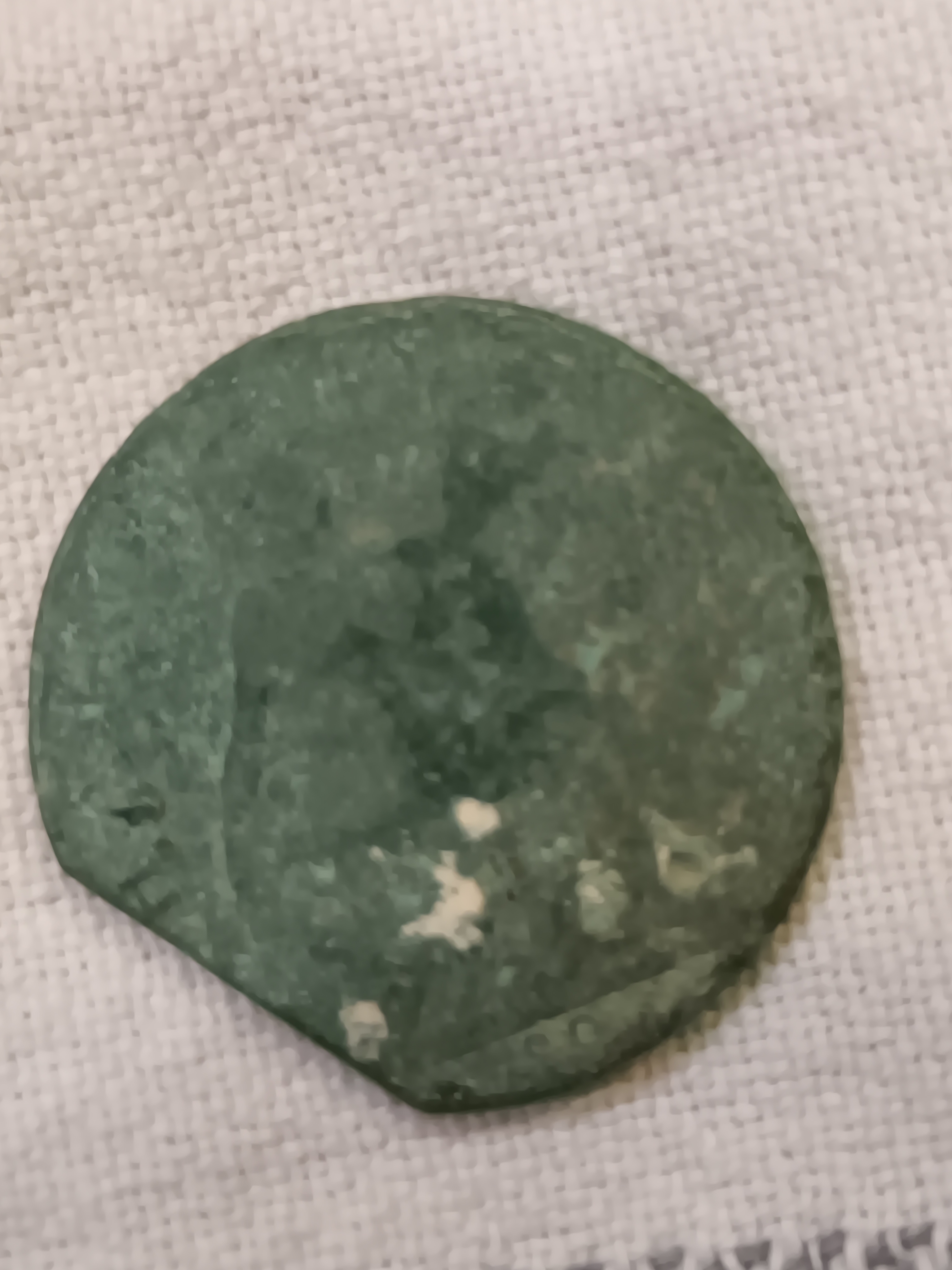
Evidence of Romans
by Mike Hopkins
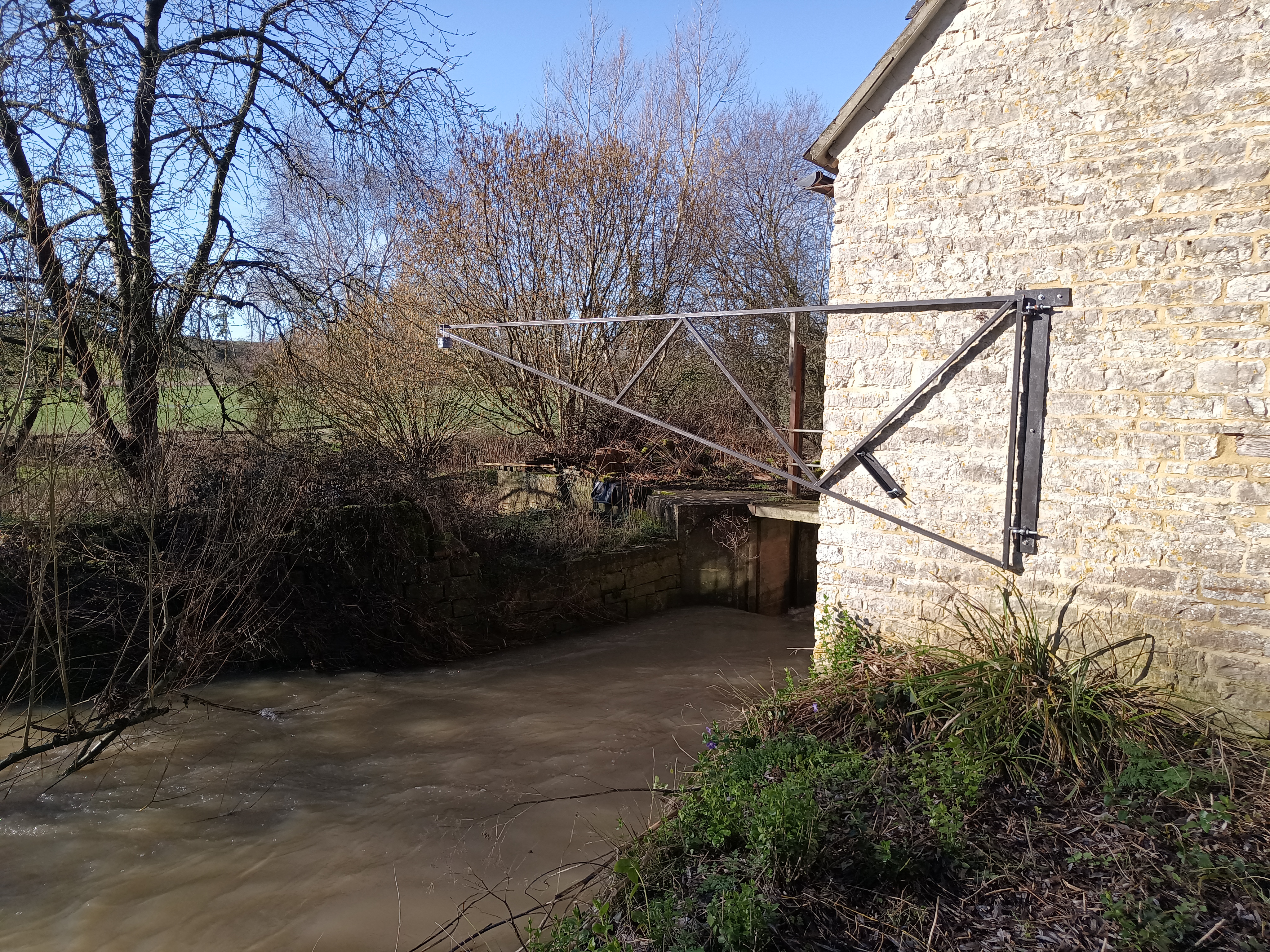
Understanding the river behaviour.
by Mike Hopkins

Pruning the fruit trees
by Mike Hopkins

More Floods
by Mike Hopkins

Last day of the year.
by Mike Hopkins

Bumper sloes!
by Mike Hopkins

Dry(ish) and Dramatic.
by Mike Hopkins

Crop Protection
by Mike Hopkins

We've got it covered!
by Mike Hopkins
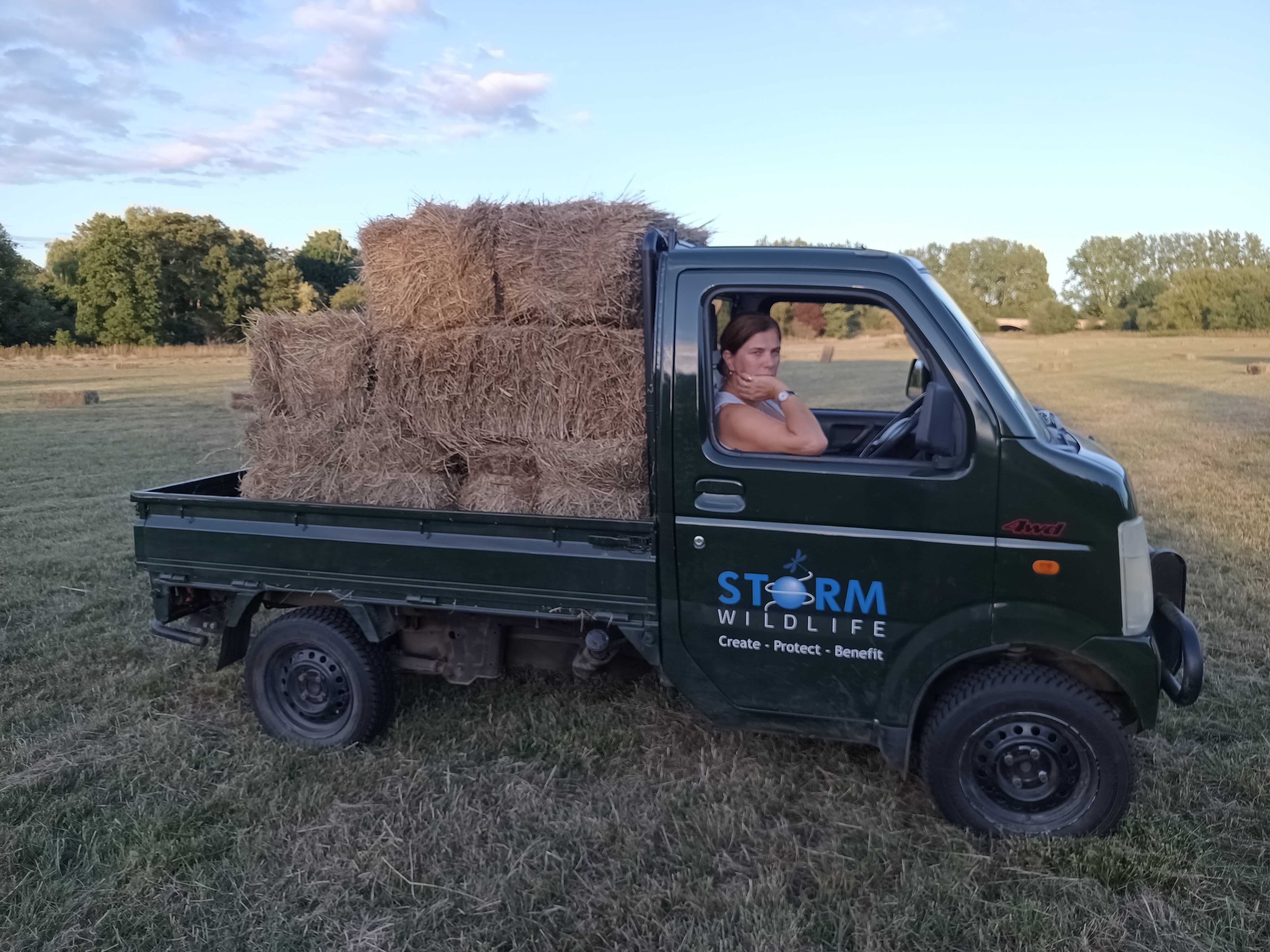
Hay nonee no!
by Mike Hopkins

Off with their heads!
by Mike Hopkins
Too much of a good thing!
by Mike Hopkins

Enter the Scythe
by Mike Hopkins

Bankside vegetation, birds and butterflies.
by Mike Hopkins

It's a Golf Course.
by Mike Hopkins

Trees arrive for Oxbow Orchard.
by Mike Hopkins

First units sold.
by Mike Hopkins

River Behaviour.
by Mike Hopkins

What is that?
by Mike Hopkins

Horses on....horses off.
by Mike Hopkins

More seed going in.
by Mike Hopkins

Scrapes are holding water.
by Mike Hopkins

Intense Rain
by Mike Hopkins

Plugging them in.
by Mike Hopkins

Easy pickings.
by Mike Hopkins

Make hay while the sun shines!
by Mike Hopkins

Invasion of Bristly Oxtongue!
by Mike Hopkins

Some apple trees are in trouble.
by Mike Hopkins

The wonder of it!
by Mike Hopkins

Apple trees doing well!
by Mike Hopkins

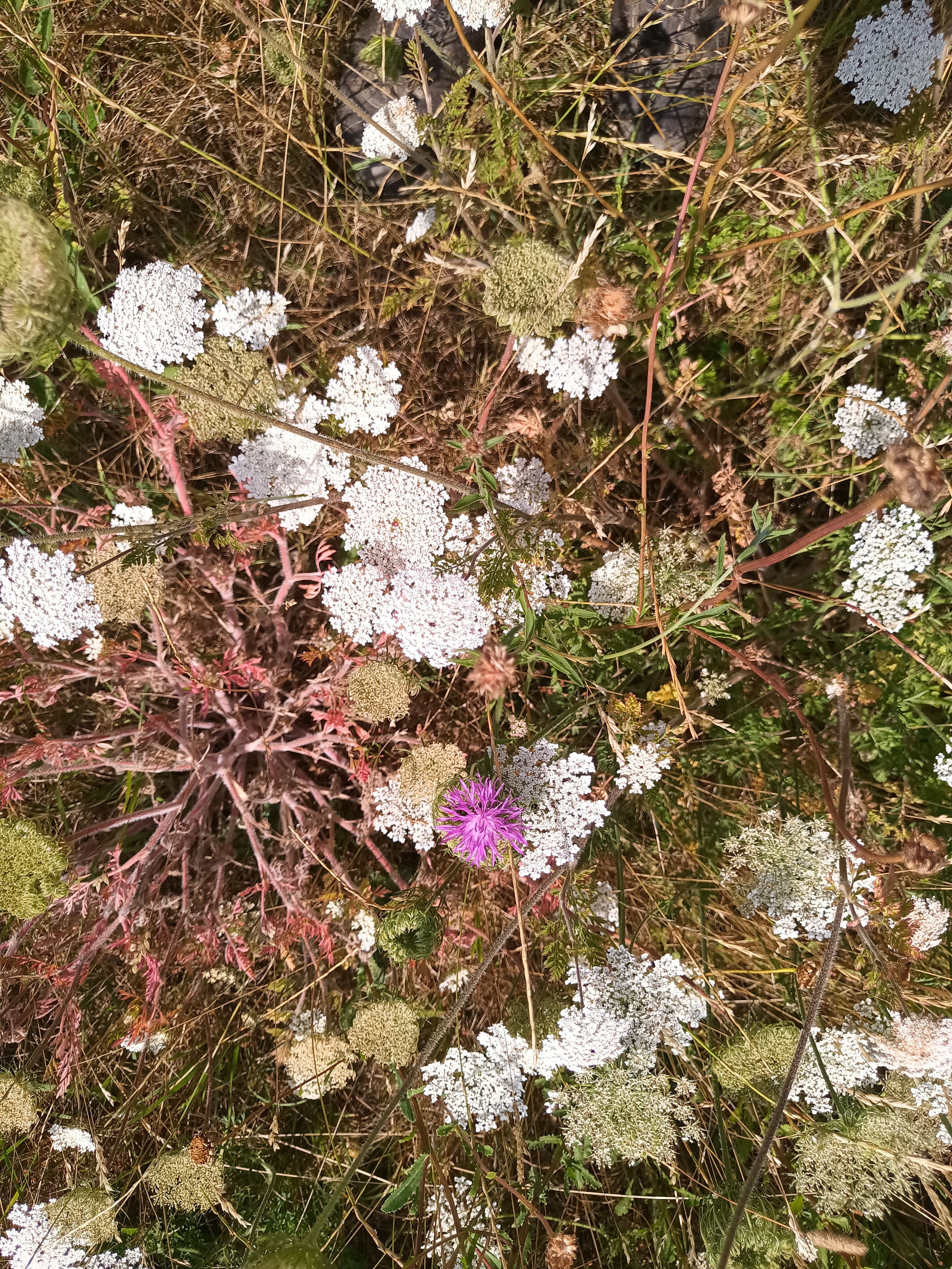
Counting plant species.
by Mike Hopkins

Shake Rattle and Roll!
by Mike Hopkins

D'Arcy Spice and all things nice!
by Mike Hopkins

Snake's-head fritillary pops up!
by Mike Hopkins

Early spring shows positive signs.
by Mike Hopkins

BNG starts here.
by Mike Hopkins

First flood this autumn.
by Mike Hopkins

Sowing the seed.
by Mike Hopkins

Aftermath Grazing.
by Mike Hopkins

All round good yield!
by Mike Hopkins

Some success!
by Mike Hopkins

Indicator Species Found in Halford Flood Meadow
by Mike Hopkins

Biodiversity Units are now on sale to developers.
by Mike Hopkins

The ups and downs of managing a flood meadow
by Mike Hopkins

Time for another soil test
by Mike Hopkins

Dry February
by Mike Hopkins

Time for Action.
by Mike Hopkins

Paperwork is essential to save the planet.
by Mike Hopkins

Halford Flood Meadow features in Seville Conference.
by Mike Hopkins
Making way for orchards.
by Mike Hopkins

Purple-loosestrife
by Mike Hopkins

Making Hay
by Mike Hopkins

Sowing the seed!
by Mike Hopkins

The time is now!
by Mike Hopkins

Considering the Flood Meadow Management Plan
by Mike Hopkins

Fish live in trees too!
by Mike Hopkins

Full House at the Village Hall.
by Mike Hopkins

Environment Agency initial approval in principal.
by Mike Hopkins

Initial results from topographic survey.
by Mike Hopkins

Detailed Topographic Survey
by Mike Hopkins

Habitat Assessment.
by Mike Hopkins

The surveys begin!
by Mike Hopkins

Middlemarch Environmental Appointed
by Mike Hopkins

Storm Wildlife have purchased Halford Flood Meadow
by Mike Hopkins